Sandia Crest recreation area closed until January 2027. Click here for details and alternative hiking routes.
Introduction
Recreational opportunities abound in the Sandia Ranger District. To learn more, please refer to the “Visitor Recreation Guide and Map to the Sandia and Manzanita Mountains,” by clicking here.
Click on the links below to learn more about opportunities in the Sandia Mountains for:
- Hiking
- Backpacking
- Mountain Biking
- Winter Activities
- Hang Gliding
- Rock Climbing
- Horse and Mule Trails
- Bird Watching
Safety
Safety is the paramount issue in enjoying the mountains. Local search and rescue teams are called to the Sandias several times a year, and the outcome is tragic far too often. Mike Coltrin, FOSM member and originator of this website, included a comprehensive review of safety issues in his opus Sandia Mountain Hiking Guide including:
- Sun
- Snow
- Weather Patterns
- Lightning
- Flash Floods
- Rattlesnakes
- Bears
- Poison Ivy
- Plague
- Heat Exhaustion
- Hypothermia
- Altitude
- Getting Lost
The complete safety section from this superb guide book is available in pdf form here. The included standalone map is available here.
Cell phone connectivity can be spotty to nonexistent in the Sandias depending on location and carrier. This can become a critical problem if hiking alone. Garmin’s inReach communications devices, while pricey, provide excellent satellite communications and GPS tracking. Apple and T-Mobile (and perhaps others) offer satellite-based text-message connectivity.
FOSM member and Sandia Ranger District volunteer Jamey Browning is working with the Forest Service and rescue organizations to develop signage and maps to improve hiker safety particularly on the iconic but frequently hazardous La Luz Trail. The safety recommendations in the documents below apply equally to all Sandia trails.


Maps
Having the appropriate map is critical for safely enjoying the many trails in the Sandias and Manzanitas. Smartphone applications such as Gaia GPS, AllTrails, Strava, Waymarked Trails, and TrailForks are excellent means of acquiring and using maps including GPS guidance. Most provide some functionality with free versions, but an annual subscription usually is required for full functionality (such as downloading maps). (Note: You do not need cellular connection for the GPS chip in your smartphone to work, which makes these apps so useful; however you do need to have pre-downloaded a map for your current location to show on it.)
Some of these applications allow you to upload your own tracks and create routes composed of multiple trails. FOSM member Jamey Browning is in the process of adding popular routes in the Sandias to Waymarked Trails. The app sorts routes into several categories including hiking, mountain biking, horse riding, and winter sports.
Other resources include:
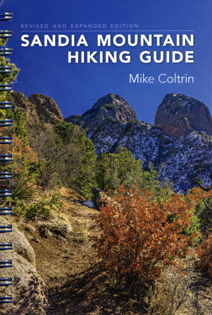
Mike Coltrin vacated his website for hiking in the Sandias (sandiahiking.com), but he granted FOSM permission to link from this website to an archive copy in the interest of passing along legacy data related to the Sandia trails (including GPS waypoints and GPS tracks of many of the Sandia Trails). See also: Sandia Mountain Hiking Guide – UNM Press.
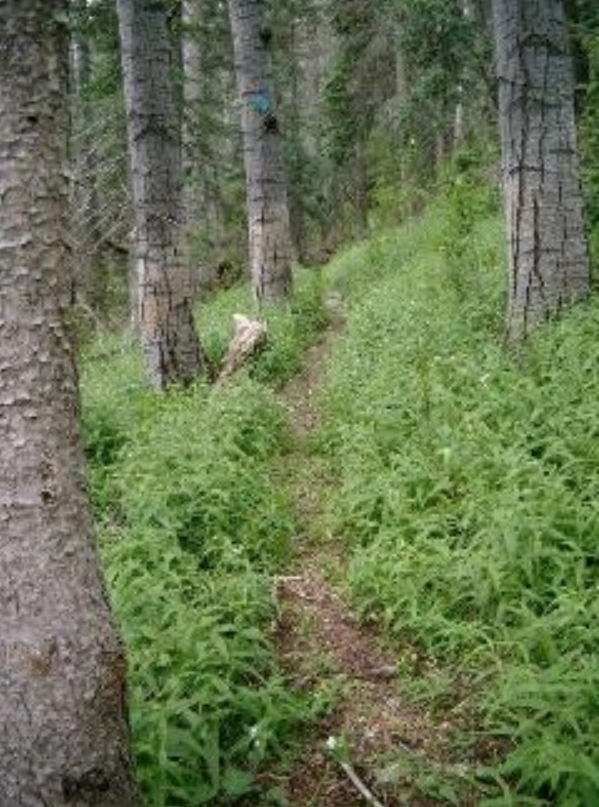
Trails
The table below lists many of the official (maintained) trails in the Sandia Mountains. Many are used year round for hiking, mountain biking, snowshoeing, and cross-country skiing. Lengths shown are one-way.
| Difficulty Rating | Trail Number | Trail Name | Length (miles) | Elevation Change (ft) |
| Easy | 196 | Bill Spring | 0.7 | 231 |
| 365 | Foothills | 13 | 800 | |
| 265 | Oso Corredor | 2.7 | 701 | |
| 72 | Sandia Cave | 0.5 | 84 | |
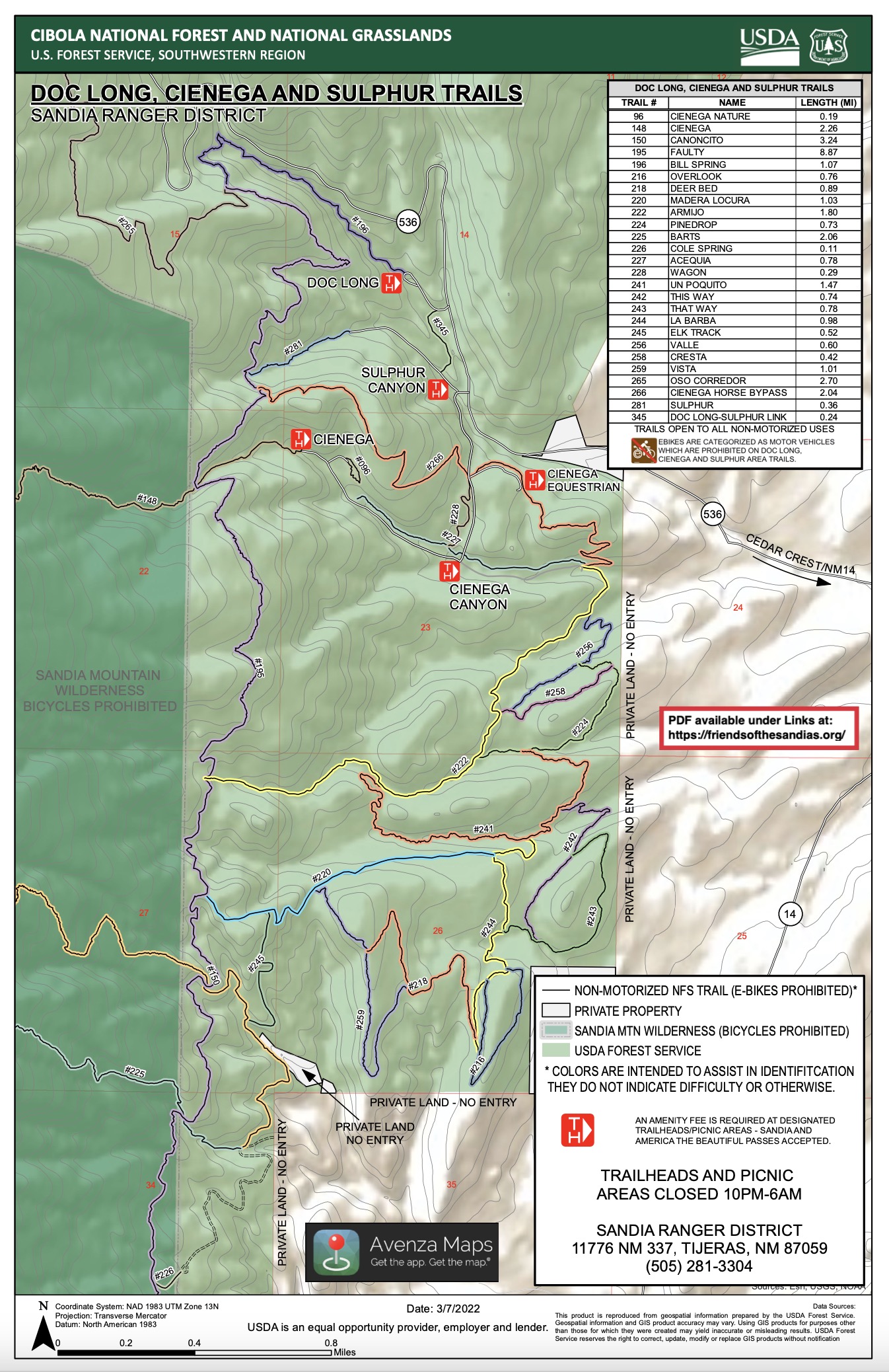
| 281 | Sulphur Canyon | 0.4 | 109 | |
| Moderate | 148 | Cienega | 2.2 | 1,659 |
| 202 | Ellis | 2.7 | 630 | |
| 195 | Faulty | 9 | 808 | |
| 200 | 10K | 4.9 | 572 | |
| 201 | Osha Loop | 2.7 | 246 | |
| 259 | Penasco Blanca | 1.6 | 520 | |
| 51 | Strip Mine | 2.6 | 933 | |
| 264 | Tecolote | 1.2 | 180 | |
| 194 | Three Gun | 4 | 2,133 | |
| 82 | Tramway | 2.6 | 929 | |
| 147 | Tree Spring | 2 | 1,039 | |
| 195A | Upper Faulty | 1.3 | 48 | |
| Difficult | 225 | Bart’s | 2.1 | 1,879 |
| 150 | Canoncito | 3.1 | 1,935 | |
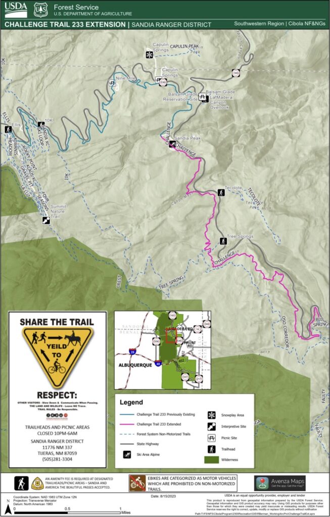
| 233 | Challenge | 9.2 | 2,550 | |
| 84 | Crest Spur | 0.6 | 507 | |
| 192 | Embudito | 5.6 | 3,039 | |
| 193 | Embudo | 3.2 | 1,749 | |
| 215 | Hawk Watch | 1.2 | 930 | |
| 137 | La Luz | 7.7 | 3,775 | |
| 130N | North Crest | 10.6 | 4,118 | |
| 247 | Osha Spring | 4.5 | 2,708 | |
| 135 | Piedra Lisa | 5.8 | 2,099 | |
| 140 | Pino | 4.7 | 2,798 | |
| 130S | South Crest | 16 | 4,081 | |
| 214 | CCC | 1.8 | 1,702 | |
| 230 | Domingo Baca | 2.4 | 739 |
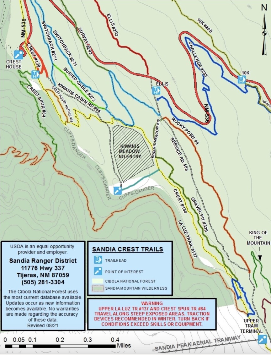
La Luz Trail is such an iconic and potentially dangerous hike that we’ve created a separate top-level webpage describing the trail and its risks.
NOTES: For more details on trails see “Sandia Mountain Hiking Guide” by Mike Coltrin and the Sandia Ranger District Map, both available at the Sandia Ranger District Station in Tijeras.
Trail Conditions
The best way to monitor trail conditions and contribute to their maintenance is to become a member of Cibola Trail Rangers. A webpage provides recent reports of general conditions or specific hazards or obstacles gleaned from reports by CTR members or other hikers. A separate page provides information specific to La Luz Trail conditions. Further information and pictures can be found on the Sandia Snowshoe Classic and Winter Scenes pages during winter.
Climb the mountains and get their good tidings. Nature’s peace will flow into you as sunshine flows into trees. The winds will blow their own freshness into you, and the storms their energy, while cares will drop off like autumn leaves. — John Muir
Last updated 3 months ago