Sandia Crest recreation area closed until January 2027. Click here for details and alternative hiking routes.
Hiking opportunities on the Sandias are endless. Some 200 miles of trails cover all parts of the mountain, both inside and outside the Wilderness ranging from 5,000 to 10,000 feet elevation. Entry to the trails network can take place on any side of the mountain from the Albuquerque Foothills, to Placitas, to Tijeras Canyon, to the east side via the Sandia Crest Scenic Byway.
A list of many popular official (maintained) trails in the Sandias can be found here. Included below are trail summaries for a quick overview of some options you may want to consider.
La Luz Trail is such an iconic and potentially dangerous hike that we’ve created a separate top-level webpage describing the trail and its risks.
The best way to monitor trail conditions and contribute to their maintenance is to become a member of Cibola Trail Rangers. A webpage provides recent reports of general conditions or specific hazards or obstacles gleaned from reports by CTR members or other hikers. A separate page provides information specific to La Luz Trail conditions. Further information and pictures can be found on the Sandia Snowshoe Classic and Winter Scenes pages during winter.
For much more complete information, please look into the following sources:
- Visitor Recreation Guide & Map to the Sandia and Manzanita Mountains
- USFS Sandia Ranger District Map
- Mike Coltrin’s Sandia Mountain Hiking Guide (book)
- Web sites:
Cibola National Forest and National Grasslands – Sandia Mountains
Mike Coltrin’s site for hiking in the Sandias. The original website (sandiahiking.com) was vacated by Mike, but he has given FOSM permission to provide a link from this website to this archive copy in the interest of passing along legacy data related to the Sandia trails (including GPS waypoints and GPS tracks of many of the Sandia Trails).
Popular Short Hikes
(One-way distances are given.)
S. Crest Trail 130 from Sandia Crest to Upper Tram Terminal, 1.75 miles, 300-ft elevation change, views of Albuquerque and northern N. M.
S. Crest Trail 130 and Trail 94 from Sandia Crest to Kiwanis Cabin, 1 mile, 100-ft descent, beautiful stone house built by CCC in 1930s.
S. Crest Trail 130 and Trail 94 from Upper Tram Terminal to Kiwanis Cabin, 1.5 miles, 200-ft ascent, with views of Kiwanis Meadow and Rio Grande Valley.
N. Crest Trail 130 from Sandia Crest to Del Agua Overlook, 2 miles, 640-ft descent, views of the north Rio Grande valley and Jemez Mountains.
Tree Spring Trail 147 to Overlook, 2 miles, 1020-ft ascent, views of Albuquerque.
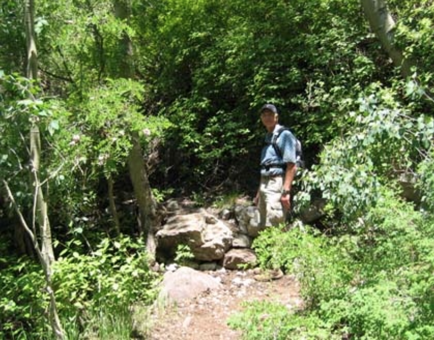
Bill Spring Trail 196 from Doc Long Picnic Area to Faulty Trail 195, 1 mile, 440-ft ascent, see Abert’s squirrels.**
Sulphur Canyon Trail 281 to Faulty Trail 195, 0.5 mile, 280-ft ascent, hike through mixed conifer forest.**
Cienega Canyon Trail 148 to Faulty Trail 195, 0.5 mile, 240-ft ascent, hike along creek.**
(**3-mile to 5-mile loops may be hiked by combining these picnic area trails with return trails parallel to the roads.)
Embudo Trail 193 to water fall at canyon mouth, 1 mile, 320-ft ascent, western Sandia foothills.
S. Crest Trail 130 from Canyon Estates to Travertine Falls, 0.5 mile, 260-ft ascent, see calcium carbonate deposits on rocks.
La Luz Trail 137 to Tram Trail 82 junction, 1 mile, 360-ft ascent, views of Juan Tabo Basin.
La Luz Trail 137 to Overlook, 3 miles, 1160-ft ascent, views of La Cueva Canyon.
Tramway Trail 82 from Lower Tram Terminal to La Luz Trail 137 junction, 2.5 miles, 840-ft ascent, hike along escarpment of Sandias.
S. Piedra Lisa Trail 135 to Rincon Ridge, 2 miles, 1230-ft ascent, views of Shield to east.
Trails That Tell a Story
Learn more about Sandia Mountain nature and history by visiting these self-guided informational trails.
Tijeras Pueblo Archaeological Site – The site interpretive trail begins behind the Sandia Ranger Station and winds past numerous interpretive signs describing the the14th century Tijeras Pueblo.
Cedro Creek – Pick up the brochure for this trail at Sandia Ranger Station and follow the numbered signposts. This one mile trail is located at the Otero Canyon Trailhead about three miles south of the Ranger Station in the Manzanita Mountains and focuses on Cedro Creek riparian habitat.
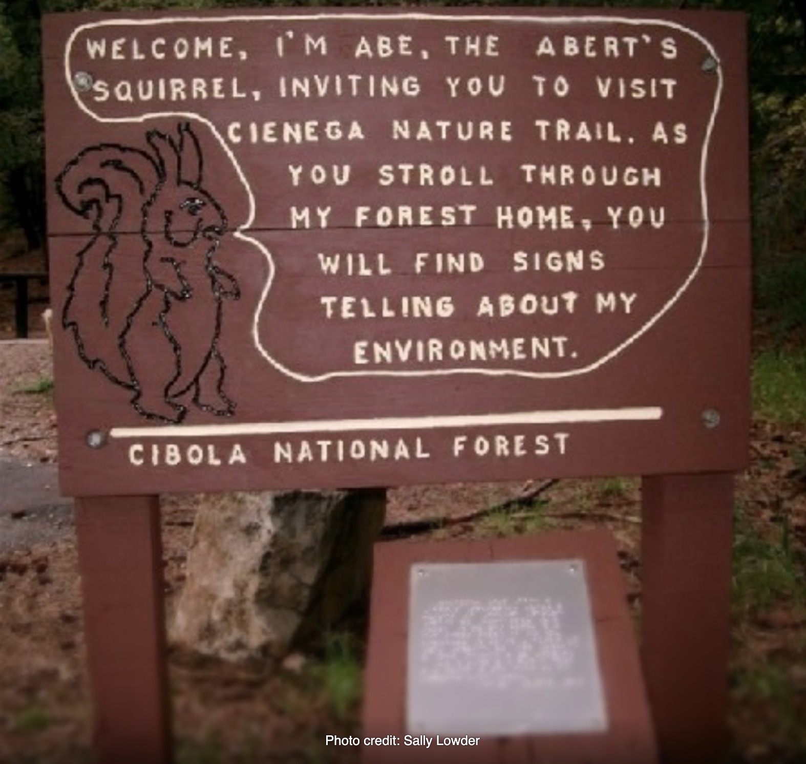
Cienega Nature Trail – Located in the Cienega Picnic Area, this short trail has illustrated signs in addition to Braille for the visually impaired and a paved walkway for visually or mobility impaired visitors. Learn about the ponderosa pine and meadow ecosystems. A small stream runs through the meadow.
Balsam Glade – This trail begins at Balsam Glade Picnic Area and leads to an overlook at La Madera Canyon. Learn about plants and animals that make their home in the mixed conifer life zone.
Sandia Peak Upper Tram Terminal – This ¾ mile loop trail is north of the High Finance Restaurant. Illustrated signs introduce the sub-alpine forest ecosystem. In summer, guided tours are available.
Sandia Crest – This ¾ mile loop trail begins south of the Crest House. It offers spectacular views of the Rio Grande valley and takes visitors into the sub-alpine forest. Most of the illustrated signs are identical to the Sandia Peak trail mentioned above.
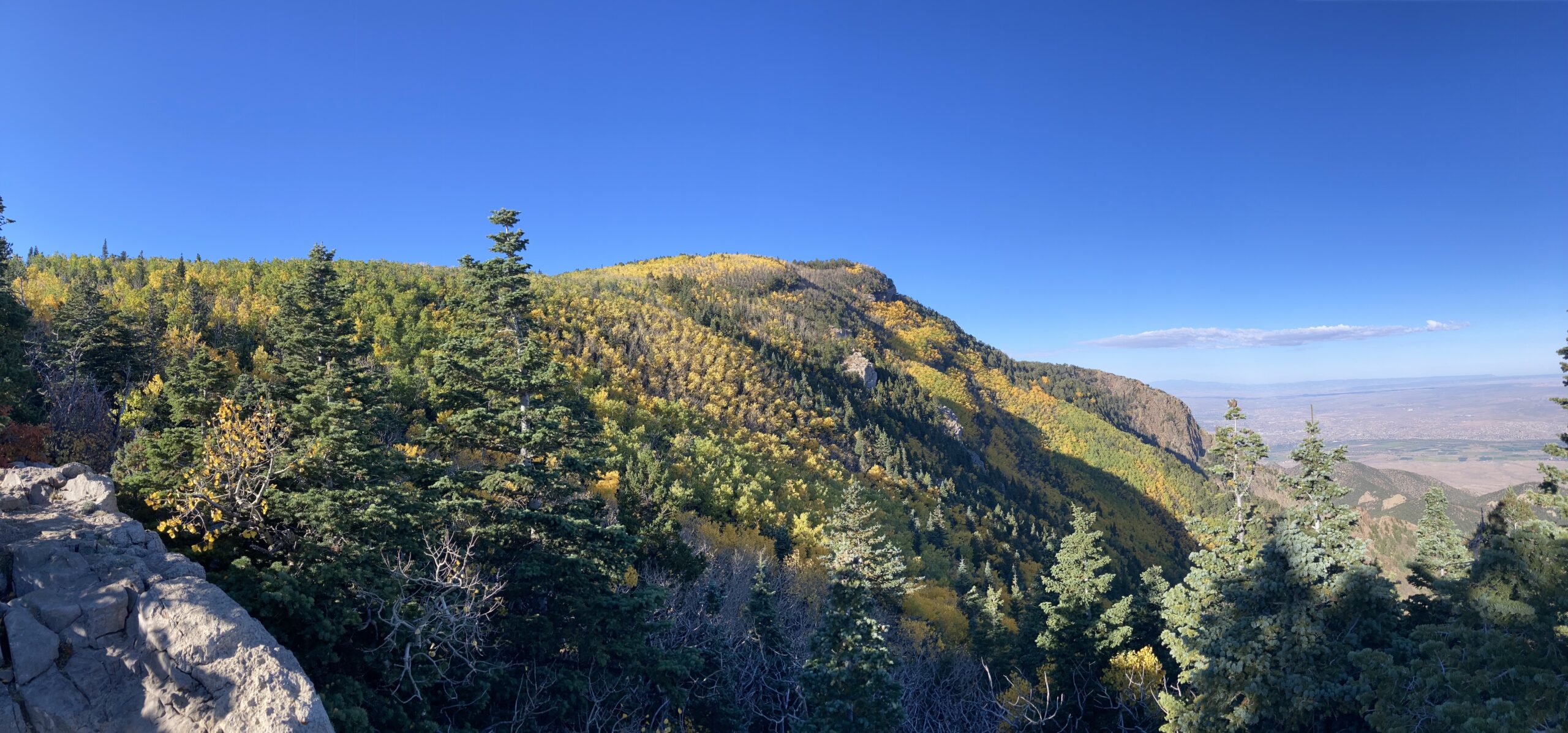
Alternative Routes to Del Agua Overlook
Del Agua Overlook is one of the most popular destinations year round but especially in the fall to see North Sandia Peak covered in golden aspens. There are four ways to get there from trail heads along the Crest Highway: 10K North, Ellis, Survey, and North Crest Trails.
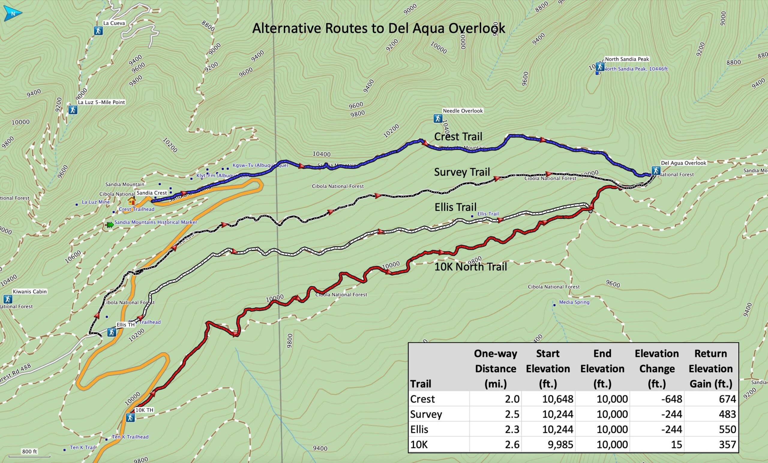
The map above provides distance and elevation gain information for the four routes. The last column in the table lists the accumulative elevation gain on the hike back. Ellis Trail has more up and down as well as more sun exposure than the other trails.
Instead of an out-and-back hike, many hikers prefer to make a loop out of the journey using Switchback and Challenge Trails or the Kiwanis Meadow Road on the south side of Crest Highway to return to their starting point. Over a half-dozen options are available to avoid retracing one’s outbound track.
Last updated 2 months ago