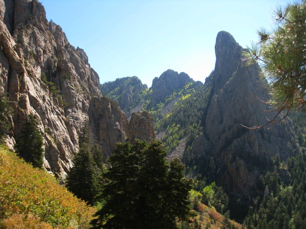
La Luz* is one of the most-popular trails in the Sandia Mountains. The views are spectacular with a true sense of adventure along the way.
However, La Luz also is one of the most challenging trails in the Sandias. During summer, the trail takes you from the hot desert to the cool Canadian forest in the upper Sandias. The trail is 7 ¾ miles long with an elevation gain of 3,775 feet. Many hikers start at the lower Tram terminal which increases the hike to 9.6 miles with 4,000 feet of elevation gain.
Hiking La Luz is strenuous and only recommended for people who are well prepared physically and able to take care of themselves in the event of a mishap. Cell phone coverage is poor, and it may become necessary to spend the night on the trail. This is no fun during a winter ice storm or a summer drenching rain.
Click on the image at right to check out this great video about hiking the La Luz Trail created by our friends at the Sandia Mountain Natural History Center. In this instance, the hiker rode the Sandia Peak Aerial Tramway to the top then hiked down, which is a somewhat less strenuous way to experience the breath-taking views from the Tram and the steepness and ruggedness of the trail “up close and personal.”
If your plan is to hike up and ride the Tram down, be sure to check their website first to make sure the Tram will be running when you arrive after your long hike.
* The name La Luz (“The Light”) is thought to have been coined by inhabitants of old Albuquerque able to see a campfire at a now-closed mine located just below Sandia Crest. Legal issues forced cancellation of the popular La Luz Trail Run.
USFS La Luz Area Trail System Map
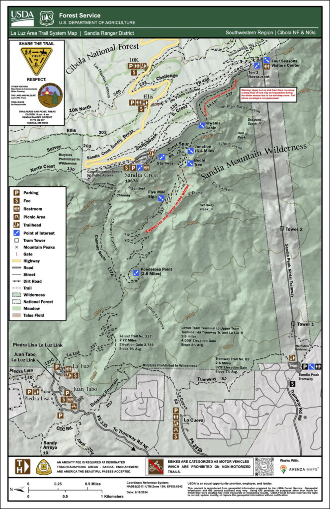
The most recent USFS Trail Map for La Luz can be found by clicking on the small-format image. The map can be downloaded and is compatible with the Avenza Maps smart-phone app.
Summer Hiking
In the summer, the trail is generally visible and easy to follow. What makes hiking La Luz strenuous is the length and relentless elevation gain. Additionally, there are few trees in the first few miles and this area can be very sunny and hot in the summer. Start early to reach the shady forest before the heat of the day.
The average slope is 9% and there are few level areas to catch your breath. There is also a talus field which is called the rockslide. This area is very rocky, and the footing is difficult. Sturdy boots are needed to protect your feet and ankles. Be prepared for late season ice and drenching thunderstorms.
Winter Hiking
In the winter, La Luz is a whole different trail. The lower areas can be warm, and hikers are often lured into continuing up the trail – unaware that hiking becomes far more difficult as they gain altitude.
The upper sections may be buried under five feet of snow , untracked, and almost impossible to follow. Winter hiking can be technical with specialized winter equipment such as snowshoes and crampons needed to reach the top. The upper sections of La Luz are very narrow and travel next to a steep cliff. Only the most experienced and prepared hikers should attempt La Luz in the winter.
Remember, you can also hike part of the trail. Use common sense when hiking. If you encounter ice and snow and don’t have the winter experience and equipment – turn around. There are many trails in the lower Sandias which are safer to hike in the winter.
La Luz Hike Smart Safety Campaign
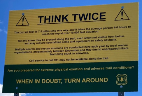
Photo credit: Jamey Browning
There have been more than 82 La Luz area search and rescue incidents in the last dozen years. Many hikers have been injured, and several people have died. During snowy years, there have been as many as 16 search and rescue incidents in one year.
While hiking La Luz is truly rewarding, it is a strenuous hike and should only be attempted by hikers in good physical shape who are aware of and well prepared for the seasonal conditions.
Always remember that up is optional on La Luz. Use common sense and turn around if needed.
In an effort to improve safety and reduce the number of rescue incidents, FOSM has partnered with the Forest Service and local search and rescue organizations including Cibola Search and Rescue, Albuquerque Mountain Rescue, and Sandia Search Dogs, New Mexico to create and support a La Luz Hike Smart Safety Campaign.
Seasonal information on hiking La Luz as well as recommended equipment (including winter traction devices) are provided in the documents linked to at the bottom of this page.
More details about the La Luz Hike Smart Safety Campaign are available here.
La Luz Trail Conditions
Recent reports of trail conditions from members of Cibola Trail Rangers and others are available here. Please provide your reports to webmaster@friendsofthesandias.org for posting. Reports about conditions on any part of the trail as well as near its terminus at the upper tram terminal or the terminus of the spur trail at Sandia Crest are encouraged and could be the difference between fun and disaster for an otherwise uninformed hiker. Photos are welcome.
Be aware that conditions can change quickly particularly during winter. Know the trail conditions before you start. Call the Sandia Ranger Station at 505-281-3304 for current trail conditions. If returning via the Tram, check their website or call ahead at 505-856-1532 to make sure they are open. Cell phone coverage is not guaranteed along the trail.
