

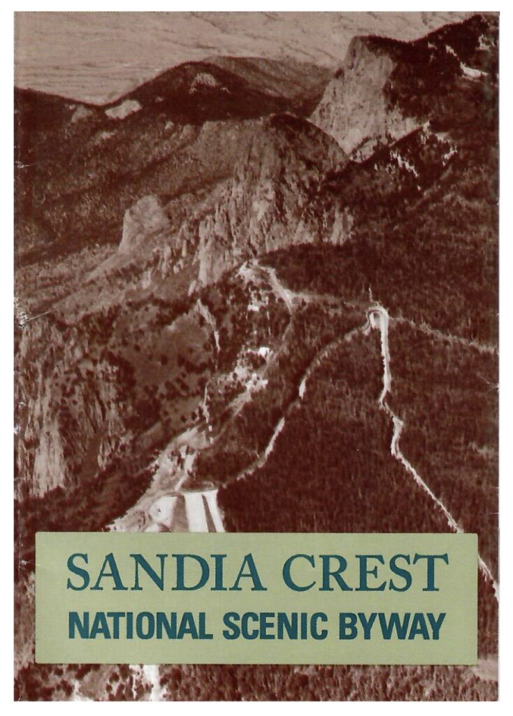
FOSM co-founder Don Carnicom has worked with the Sandia Ranger District in development and installation of signage including nature descriptions, auto tour markers, and trail maps since the founding of FOSM in 1997. Don was instrumental in the development of the Sandia Crest National Scenic Byway Auto Tour Guide and associated signage.
FOSM board member Jamey Browning, who has unique map and sign creation skills plus computer database accesses, began assisting Don with these volunteer activities in 2023. Jamey provides mapping support and has access to the SRD computer network as an official Forest Service volunteer.
Maps
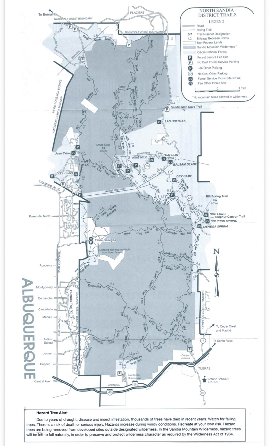
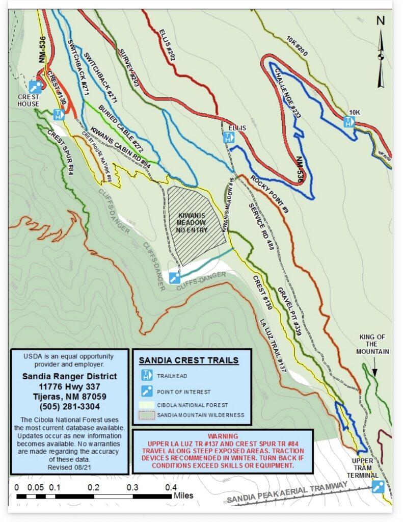
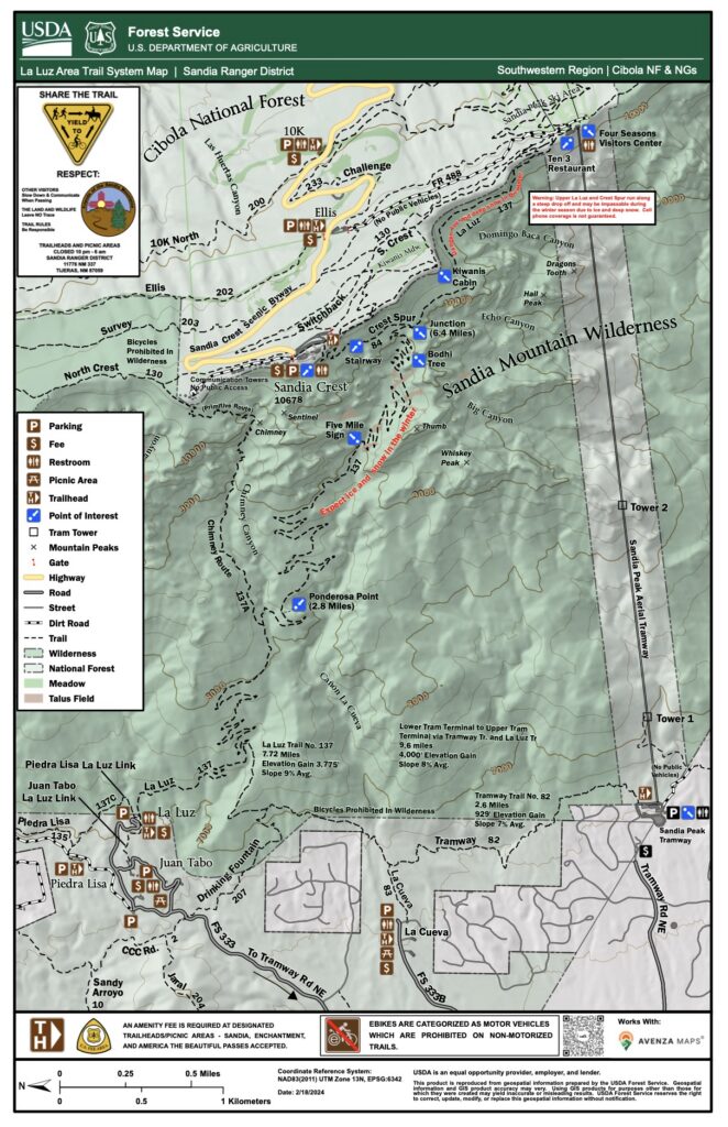
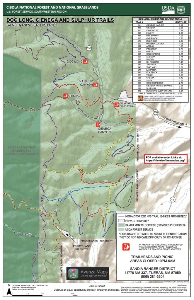
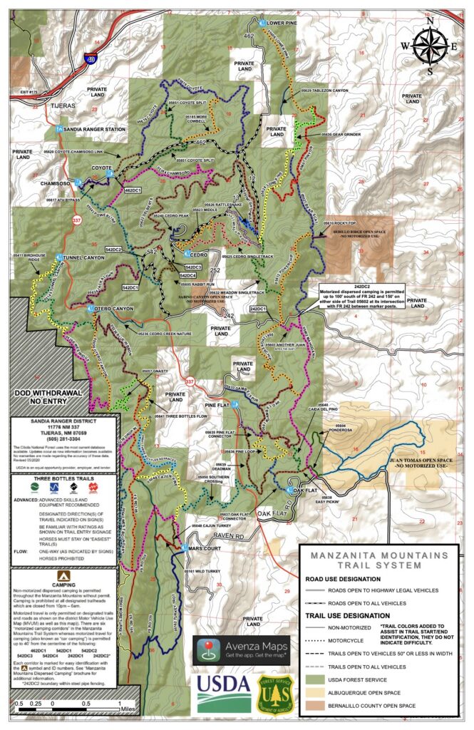
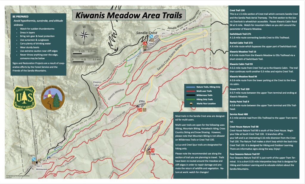
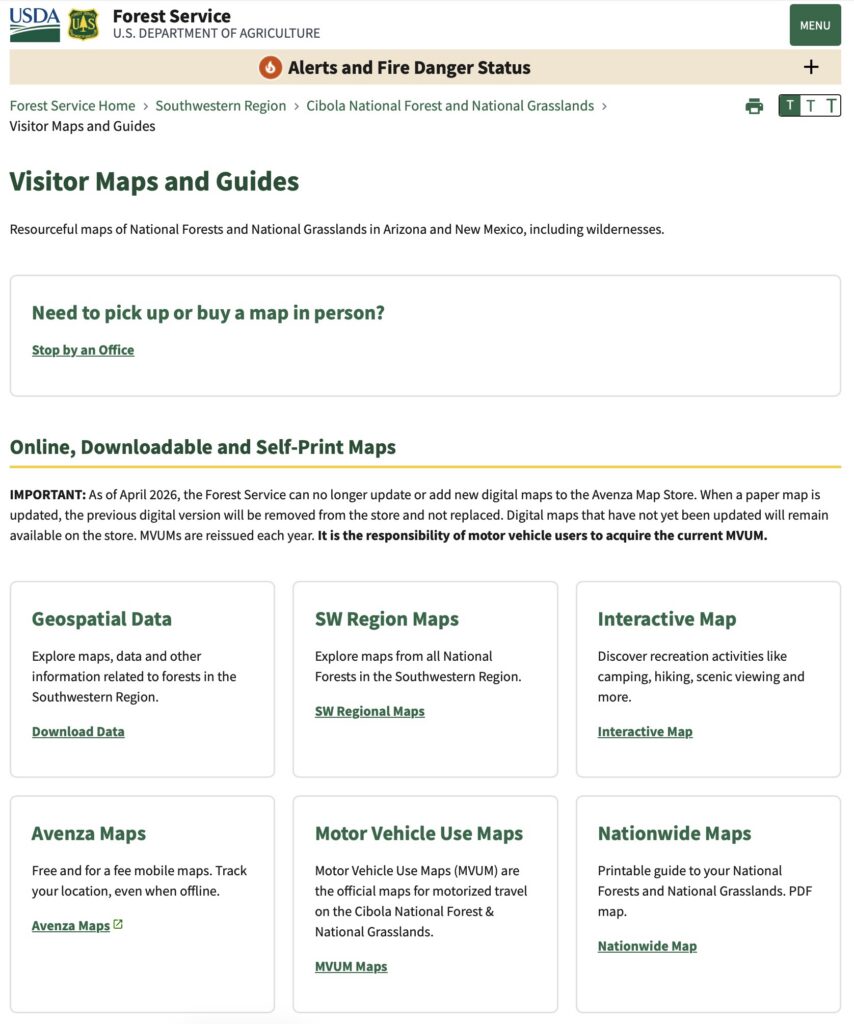
Having the appropriate map is critical for safely enjoying the many trails in the Sandias and Manzanitas. Smartphone applications such as Gaia GPS, AllTrails, Strava, Waymarked Trails, and TrailForks are excellent means of acquiring and using maps including GPS guidance. Most provide some functionality with free versions, but an annual subscription usually is required for full functionality (such as downloading maps). (Note: You do not need cellular connection for the GPS chip in your smartphone to work, which makes these apps so useful; however you do need to have pre-downloaded a map for your current location to show on it.)
Some applications allow users to upload tracks and create routes composed of multiple trails. Jamey is in the process of adding popular routes in the Sandias to Waymarked Trails. The app sorts routes into several categories including hiking, mountain biking, horse riding, and winter sports.
The cost of mapping-grade GPS receivers⏤accurate to about 1.5 meters even in canopy⏤had fallen from thousands to $500 by 2025. Jamey purchased a personal one, demonstrated its capabilities, then convinced the FOSM board of directors to purchase two units for SRD use. Subsequently, Jamey with SRD Trails & Wilderness Program Manager Canyon Young and Trails Foreman Jen Medina-Gray have surveyed a significant portion of the trail system and begun entering the new data into the USFS trails database, which is key to making new hiking maps for the Sandias and Manzanitas. The process was about 90% complete by November 2026.
FOSM participates in the AllTrails Associated Partners program, which enables Jamey to edit trail maps and information for the Sandia Mountains. Current trail descriptions in the AllTrails often are not as informative as one would wish. So, Jamey is engaged in an ongoing project to create detailed descriptions of trails and trailheads in the Sandias. Information includes the best season and times to hike the trail, whether it is sunny or shady, is it for beginning or more experienced hikers, trailhead amenities such as parking and restrooms, parking fees, allowed activities (hike, bike, horse, XC ski) and what sights may be encountered along the trail. If known, a little history about the trail is included. New descriptions available so far in the AllTrails app include:
- 10K North Trail
- 10K South Trail
- Cienega Trail
- Crest Area Trailheads
- Ellis Trail
- Golden Eagle Trail
- King of the Mountain Trail
- La Luz Trail
- Survey Trail
- Tecolote Trail
- Tree Spring Trail
- Crest Trail
- Four Seasons Nature Trail
- Domingo Baca Trail
- Pino Trail
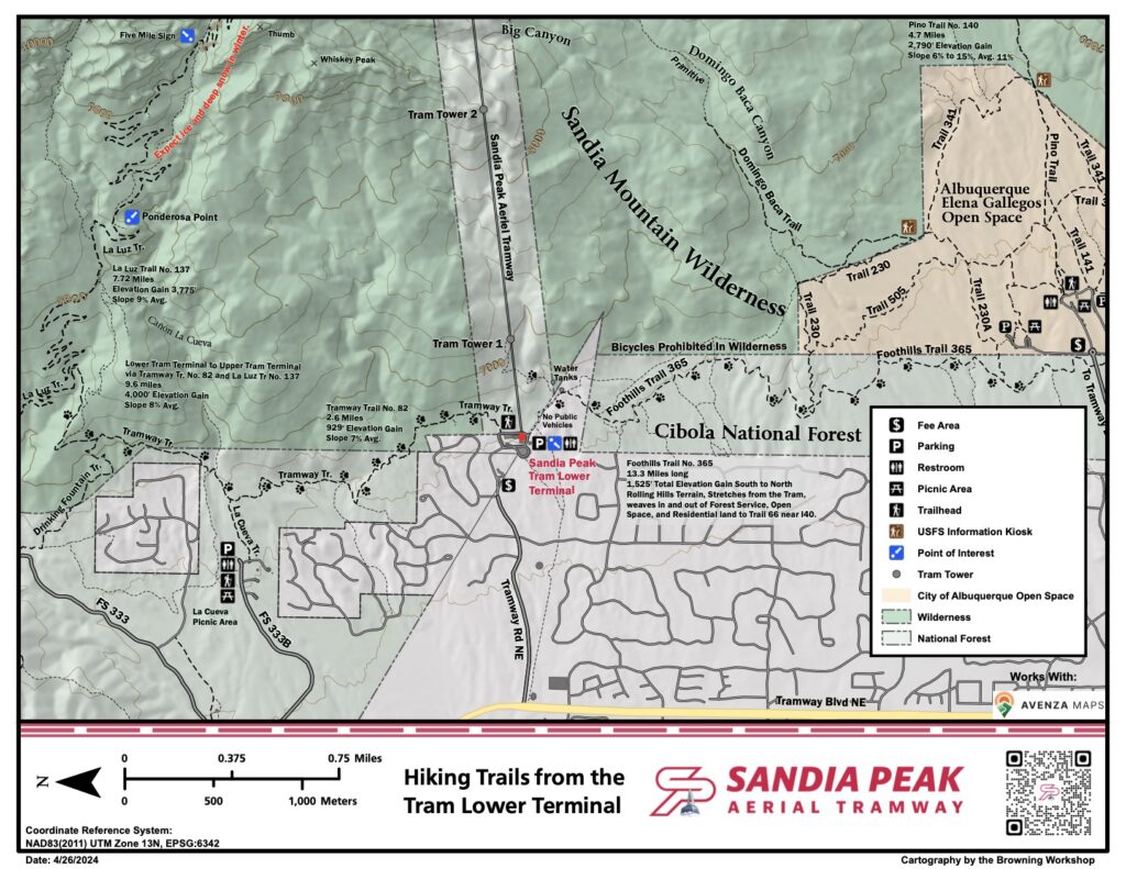
Early in 2026, SRD asked FOSM to create special maps showing alternative hiking trails available during the Crest area closure. Jamey created the five new maps below.


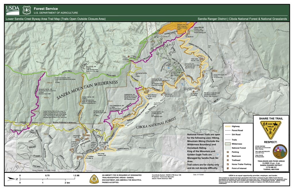
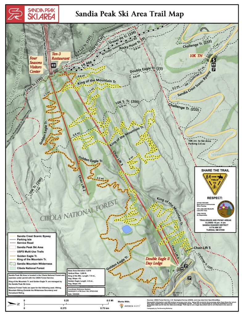
Numerous publicly available hiking and mountain-biking trails are on Forest Service land utilized by Sandia Peak Ski Area (SPSA). Per a Forest Service official, “the Tram and SPSA are located in the Cibola National Forest and operate under permit with the USDA Forest Service.” This permit does not exclude the Forest Service from having publicly accessible trails on the land used by either the Tram or SPSA.
In conjunction with volunteers from FOSM and other organizations helping clear these trails of fallen trees and other obstacles in 2026, Jamey created the adjacent map showing the locations of the trails in relation to other features of the ski area.
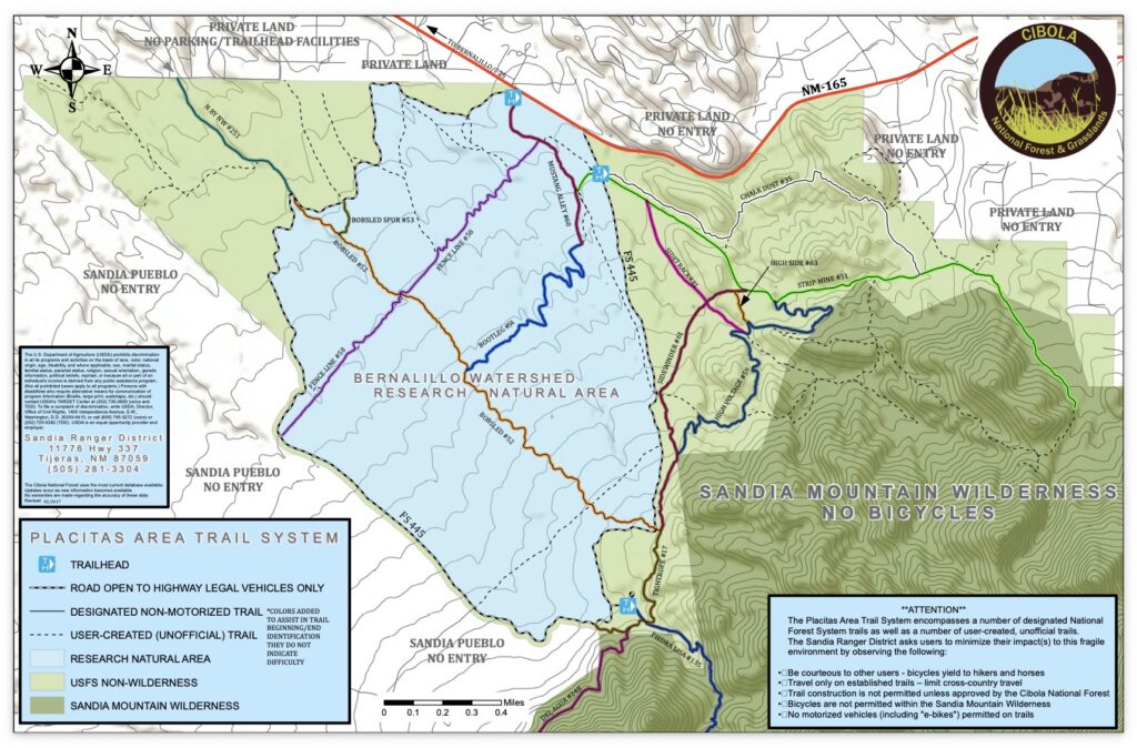
Sandia District Ranger Ken Born asked FOSM to initiate a project to create custom hiking maps for SRD kiosks. Ken’s goal is to partition the Sandia Ranger District into discrete hiking areas. There may be multiple trailheads within a map area. Each kiosk in an area will have a map with a custom “You Are Here” marker. At this stage in the planning, we we anticipate eleven maps in the Sandias and three maps in the Manzanitas:
- Placitas Area Hiking Map (Placitas trail system)
- Northern Foothills Area Hiking map (northern portion of Foothills Trail and Elena Gallegos area)
- Pino Trail Map (Pino and Crest Trail between Pino and the Tram)
- Southern Foothills Area Hiking Map (southern portion of Foothills Trail and Albuquerque Open Space Trails)
- Southeastern Sandias Trail Map (South Crest, South Faulty, Upper Faulty)
- Doc Long, Sulphur, and Cienega picnic site Trail Map (picnic area trails and the Armijo improvement area trails)
- Scenic Byway Trail Map (Tree Spring, lower Challenge, Oso Corredor, Tecolote, Balsam Glade)
- Sandia Crest / 10K South Area Trail Map (10K S, Upper KOM/Golden Eagle, Crest to Tree Spring)
- Sandia Crest / 10K North Area Trail Map (10K N, Survey, Ellis, Crest, Osha Loop)
- Sandia Crest Area Trail Map (Between the Crest and the Tram)
- Northwestern Sandias Trail System Map (North Crest, Osha Spring, Agua Sarca, Pensaco Banco)
- Tunnel Canyon / Otero Canyon / Mars Court Aea Trail Map
- Oak Flat Area Trail Map
- Cedro Peak Area Trail Map
The above gallery of downloadable maps will be augmented with new maps as they are completed by Jamey and approved by the Forest Service.
Signage
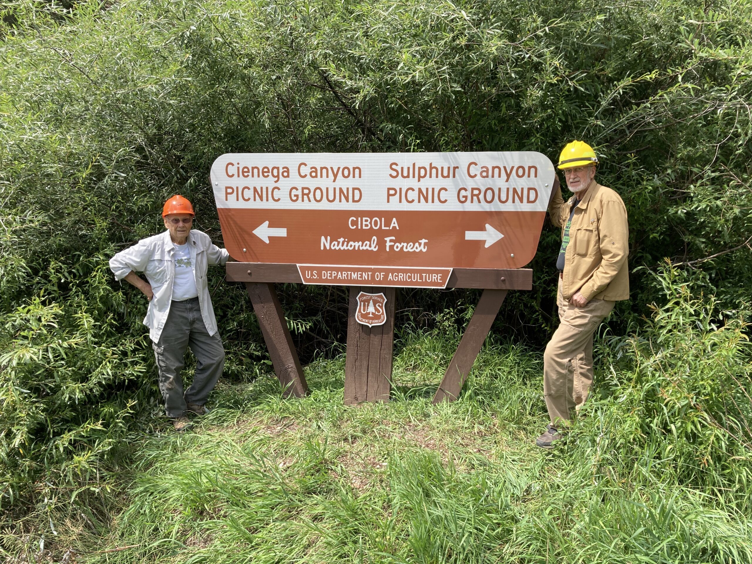
Don Carnicom procured then he and Dan Benton installed a new sign at the junction of the roads to Cienega Canyon and Sulphur Canyon Picnic Areas in August 2022.
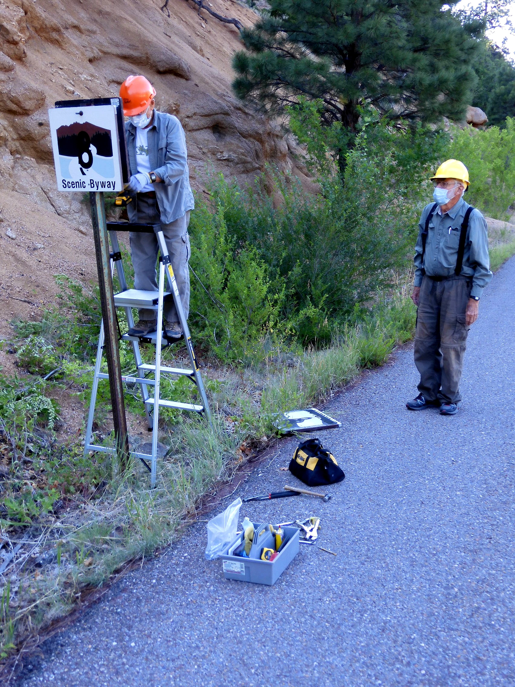
Earlier Don, Sam Beard, and Dan Benton had replaced Scenic Byway signs along the Crest Highway.
Don coordinated development and procurement of then installed 5 new maps and signs in the Crest and Cienega areas in May 2024. Three new Kiwanis Meadow Trails maps created by Jamey Browning, all alike except for the “you are here” note, were installed in the Crest area at the locations shown below. Also installed in the Crest area is a replacement for an interpretive education sign that has been in bad shape for years. A new four-foot-square Cienega Nature Trail sign created by Ken Wilson and Jamey was mounted on a long-empty kiosk panel at the beginning of the trail. (See adjacent map.)


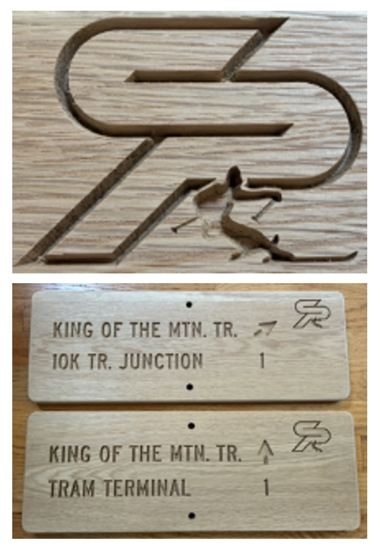
As part of the ski area trails restoration efforts, Jamey and others identified the need for 22 new trail signs for King of the Mountain and Golden Eagle Trails. Sixteen signs had been installed by November 2026. Jamey expects to finish by early 2027 depending on the weather. The adjacent image shows examples of the new trail signs.
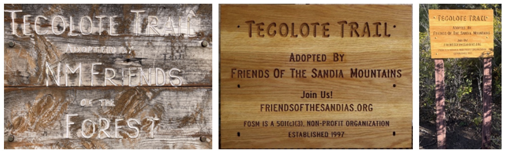
Jamey and Sam Beard created a new sign for Tecolote Trail, which has been adopted and maintained by FOSM, in 2026. The original sign had badly degraded over the years and needed to be updated from our original name to Friends of the Sandia Mountains.
Jamey used one-inch-thick white oak to make a 26” x 19.5” sign⏤the same width as the previous sign but slightly taller to incorporate additional lettering. He carved the sign using his personal CNC vertical milling machine.
Sam finished the sign with Cabot Australian Timber Oil Natural Color.
Chuck Logan, Michael Arndt, and Sam installed the new sign in July 2026.
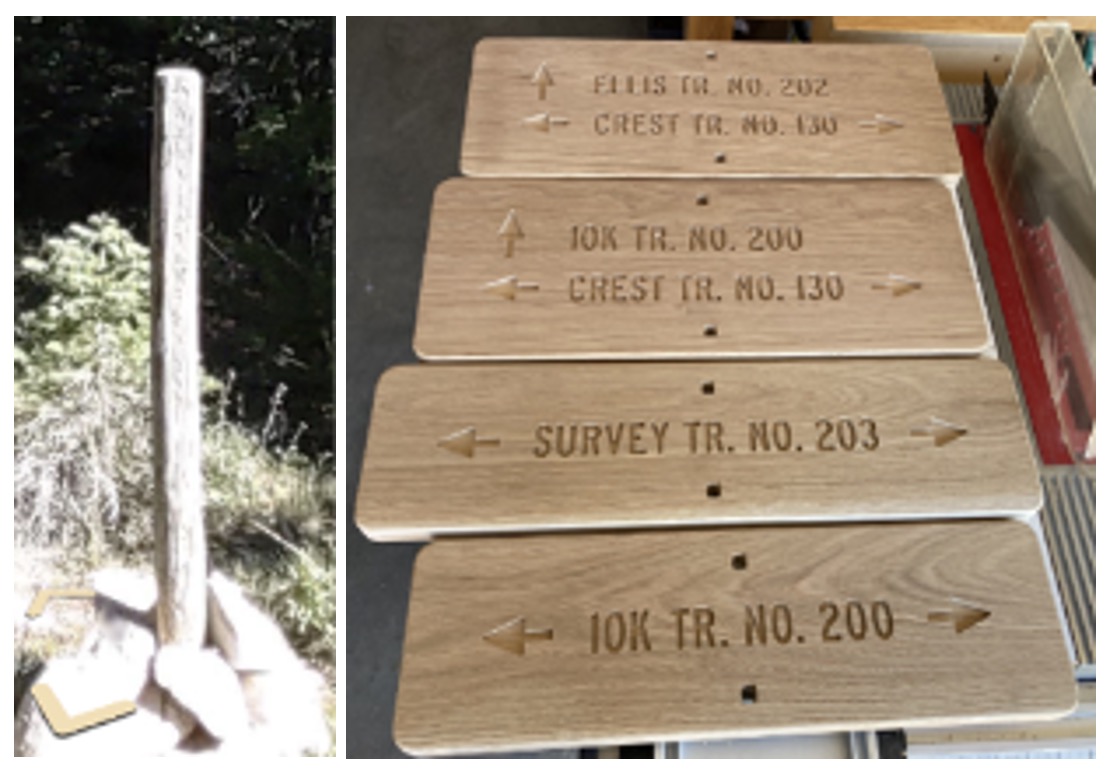
SRD Trails Foreman Jen Medina-Gray initiated a project to replace degraded trail signposts in the Sandias with new signs. At SRD’s request, Jamey created four signs for Ellis, 10K, and Survey Trails in 2025. The Forest Service installed the new signs in 2026. The plan is to continue to replace old signposts in the Sandias with informative new signs. The next area of focus likely will be the Osha Loop/Penasco Blanco trail area north of the Crest.
Then FOSM president Mike Madden suggested in 2025 that we toot our own horn a bit by creating and installing “We Help Maintain These Trails” signs to better inform the public about our work maintaining trails in the ranger district. After SRD approval, Jamey designed new signs and engaged P&M Signs, Inc., in Mountainair to make 10. By November 2026, eight had been installed on kiosks in the Sandias, and 10 more signs were on order. Note that the signs encourage trail users to join FOSM as volunteers.

Last updated 1 hour ago